Srdečně Vás zveme na pokračování seminárního cyklu Dynamická planeta Země.
Termín: 27. 5. a 28. 5. v 10:30
Místo konání: Geofyzikální ústav AV ČR, Boční II 1401, Praha 4 – Spořilov
Prof. Donat Fäh is a Swiss geophysicist and professor affiliated with ETH Zürich and the Swiss Seismological Service. His research focuses on seismic hazard assessment, earthquake risk, ground motion modeling, and historical earthquakes.
27. 5.
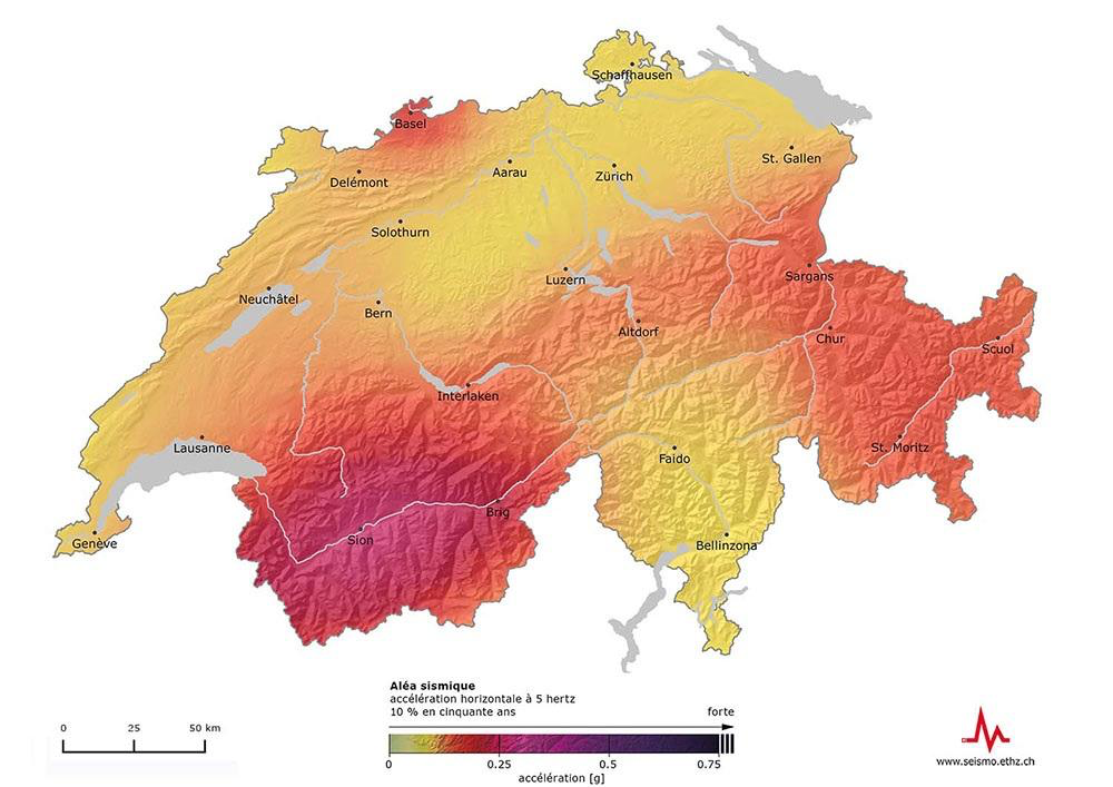
The Swiss Seismic Hazard Model: Background and National Implementation
Over the past few decades, the national seismic hazard maps for Switzerland have been revised twice. This was coordinated and harmonised with the seismic hazard analysis for nuclear power plant sites in Switzerland (the Pegasos and Pegasos Refinement projects), which were carried out in a SSHAC process. To this end, the underlying data sets were completely revised (historical and instrumental earthquake catalogues and source zoning data) and a stochastic ground motion model for Switzerland was developed. A key milestone was the development of a reference rock profile for the seismic hazard maps, which is needed when the hazard maps are used for site-specific seismic hazard assessment and microzonation with a site response layer. The national seismic hazard maps formed the basis for revising the Swiss building code (SIA 261) with regard to determining five seismic zones, defining the soil classes, shaping the elastic response spectra and establishing aggravation factors for the three importance-classes of buildings. Additionally, provisions for site-specific seismic hazard analysis and microzonation were established in a new standard (SIA 261/1, 2020). All developments are currently also being used to implement the revised Eurocodes (EC8) in Switzerland.
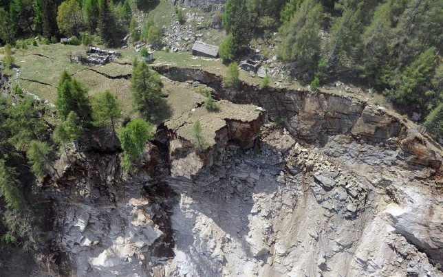
28. 5. Quantification of the seismic response of unstable slopes and its time variability
Landslides induced by earthquakes are among the major risks in the Alpine region. These include landslides in Alpine valleys and in lakes, the latter of which can lead to lake tsunamis. This risk has received little attention to date, partly because the underlying processes are complex and in parts poorly understood. In recent decades, the Swiss Seismological Service has developed various methods to address this issue. These include methods for characterising rock instabilities and sliding zones on mountain slopes and in lakes using geophysical and seismological techniques; seismic monitoring of dynamic behaviour; and modelling failure induced by earthquake excitation. The dynamic behaviour exhibits seasonal variations due to environmental influences (temperature, water and ice) as well as a continuous reduction in stability over years or decades. The various methods are presented using examples for Lake Lucerne and different rock instabilities, along with long-term monitoring of instabilities, one of which (Brinzauls) show striking changes in dynamic behaviour over just a few years.